
After a typical Saturday night where Miranda gets called into work so she can work until 02:00 (oh wait…that’s not a typical Saturday in the world of Miranda) it was decided that a few select members of the Rohirrim (the best friend group ever. Not that I am biased.) and I would go hiking up the Poudre Canyon. I received a lovely wake up first from my dog, Tippy, and then from a phone call from my friend Rico at 08:00. I don’t think I was speaking English at that point.
I dragged my sorry butt out of bed and attempted to resemble a human before the rest of the Rohirrim arrived. I was only somewhat successful. After a lot of coffee and some eggs, we went on our way… just for my check engine light to come on before we turned onto the Poudre Canyon road. So we made a bit of a pit stop to check Felicity (yes, I named my car), decided we had no idea what was going on, and proceeded after I did a lucky dance to ward off lousy car juju.
We decided on the Hewlett Gulch trail, located in the lower part of the Poudre Canyon. I had hiked the Gulch before, but the last time I had declined to check the status of the battery in my camera (like a ninny) and had a dead battery, so I was unable to take pictures. At least I learned from my mistake and made sure my camera had power this time!
According to information from the Poudre Wilderness Volunteers, the name of Hewlett Gulch comes from one of the original settlers of the Poudre, dating back to the 1870s. Hewlett Gulch is also the location of the original Poudre Park settlement, and a few remaining foundations and chimneys are still visible.
There is abundant water in the gully before you make your way up the loop and onto some alpine meadows. Adventure Dog was a fan, she loves splooshing through the water at a high rate of speed and then doing flyby splashings to unsuspecting hikers in her party.
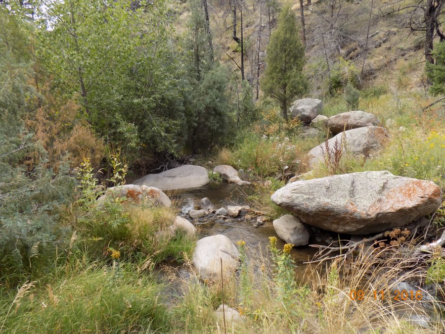
The water is from Gordon Creek and was still chuckling merrily along even though it is the beginning of September and it has been a relatively dry summer. The deepest I saw it get near designated water crossing areas was about a foot. However, the area is known for flash flooding, having received extensive damage during the floods of 2013.
The views were lovely, both from down in the gulch and up in the meadows. The far end of the trail borders private property, so seeing houses while decidedly out in the wilderness was strange. Also, the scars from the last fire in the region were still plainly visible, leading to a melancholy, stark beauty in some areas.


The weather was perfect, not too cold, and a bit of cloud cover to keep us from getting scorched by the sun. Overall, the hike took us a little over three hours to complete, and we were a mixed group of in-shape and out of shape people. There were some pretty strenuous uphill climbs, but for the most part, I would consider the hike on the easy end of the moderate spectrum. I would recommend it!
It was nice that the trail rules permitted off-leash dogs as long as they were responsive to voice commands. Trying to hike while taking in the views and not tripping over something while holding a dog is sometimes a little beyond my skill set. At least there weren’t many annoying bugs.
10/10 would recommend. I would like to eventually backpack in and pitch a tent for the night. There’s always next year!

Oh Colorado, how I love having the opportunity to live here.
Over and out!
